Achieving co-existence between People and Nature in Aichi
Aichi has taken various measures toward realizing “Aichi : Living in Harmony with Nature” through collaboration of various stakeholders.
With this group, we wish to contribute to achieving the Kunming-Montreal Global Biodivesity Framework by
promoting actions of subnational governments.
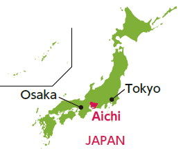
About Aichi
Population: about 7.5 million
Area: 5,163㎢
GDP: about 350 billion dollars
Main industries: Motor vehicles, aeroplanes
Nature preservation zone: about 17.2% of the prefecture
Fauna and flora: 16,940 species
Aichi Prefecture is located in the center of Japan, facing the Pacific Ocean.
While being the industrial capital of Japan, the prefecture aims to create a sustainable society that balances environmental conservation with industrial development.
The Tenth meeting of the Conference of the Parties to Convention on Biological Divesity was held in Nagoya, Aichi in 2010.
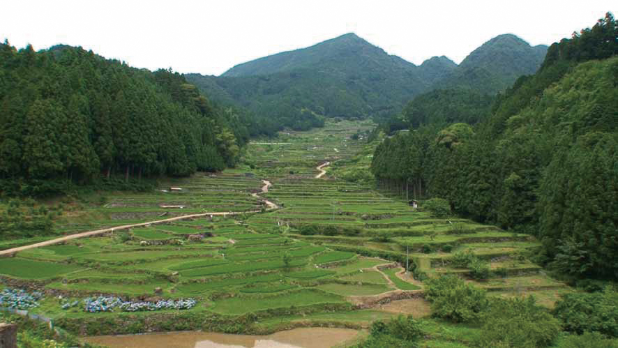
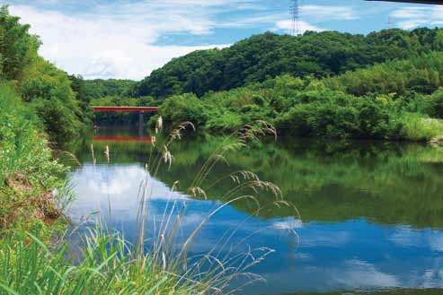
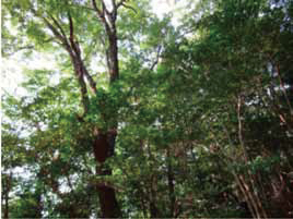
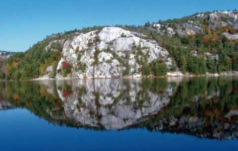
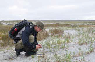
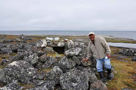
Nature in Aichi
In Aichi, you can see a variety of landscapes including mountains, forests, satoyama*,
farmlands, urban areas, wetlands, marshes, rivers and coasts.
Rice Terrace in Yotsuya
*Area between mountain foothills and arable flat land that has been developed through
centuries of human activities including agricultural and forestry use.
Yahagi River
Star Magnolia
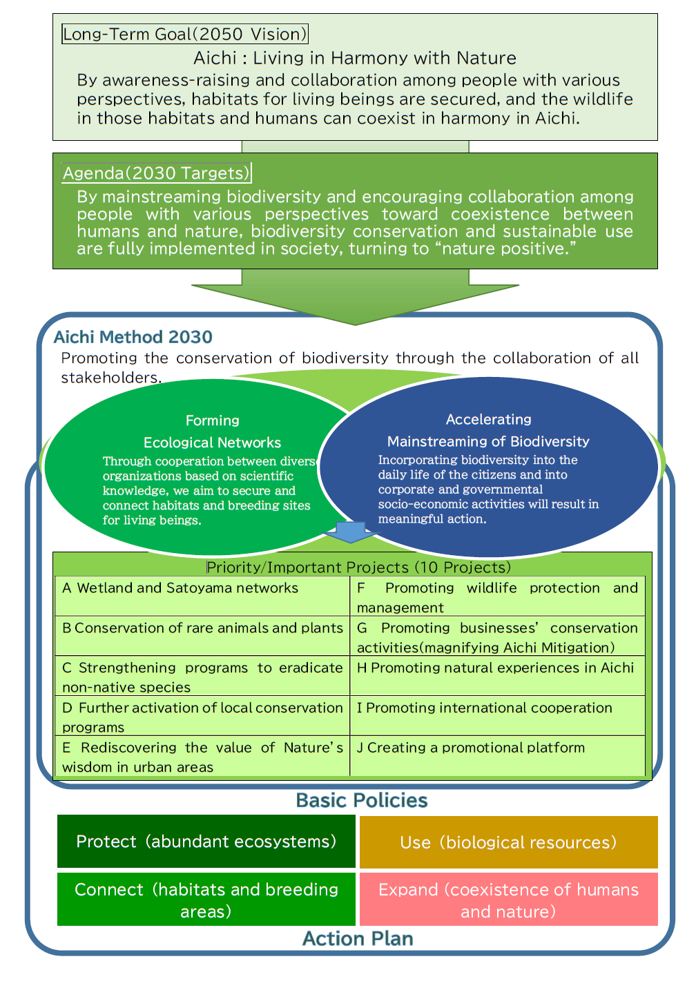
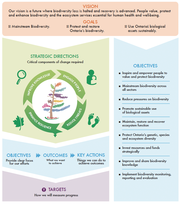
Aichi Biodiversity Strategy 2030
~Aichi : Living in Harmony with Nature~
In February 2021, Aichi Prefectural government reformulated the "Aichi Biodiversity Strategy 2030" as a regional biodiversity strategy and its action plan, which sets regional targets for Aichi Prefecture.
The strategy adopts the "Aichi Method 2030," which aims to realize "Aichi:Living in Harmony with Nature" and promotes biodiversity conservation through collaboration among all stakeholderss by fostering human connections. The Aichi Biodiversity Strategy 2030 is based on the twin pillars of "forming ecological networks" and "accelerating mainstreaming of biodiversity". Through developing various measures contributing to the pillars, Aichi Prefecture aims to be a progressive region that can contribute to the conservation of biodiversity not only in Aichi prefecture but also in the world.
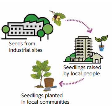
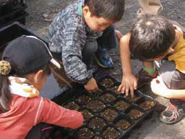
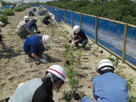
<Example of the efforts of the Ecological Network Councils>
Collaborative cultivation of seedlings to restore native forests
Seeds collected in the woods remaining on industrial sites are distributed to local
residents and elementary schools. The seeds are then planted to grow into seedlings,
which are re-planted on streets and in parks in local area.
wetland : 1960s
Landfilling to cultivation land and using as private agricultural land :
1970~2000
Restoration : 2013
The National Association of State’s Environment Authorities, Non-Profit
“The commitment is with the environment and with the life”
Integrated by:
28, State Secretaries
1, Environment’s Commission
16, Environment’s Attorney
1, Ecology’s Coordinations
2, Ecology’s Institutes
ANAAE is a coordination and work board between environment’s state authorities with the
purpose of sharing experiences, programs and actions for environmental development.
Mexico is one of the main mega-diverse countries in the world. With about 200 thousand
different species, it’s home of 10 to 12% of the world’s biodiversity. At the same time
it’s in 4th place in world’s flora, with 26,000 different species…
… It’s the 2nd country in the world in ecosystems and 4th place by the total species.
(Because 2,500 species are protected by the Mexican laws)1
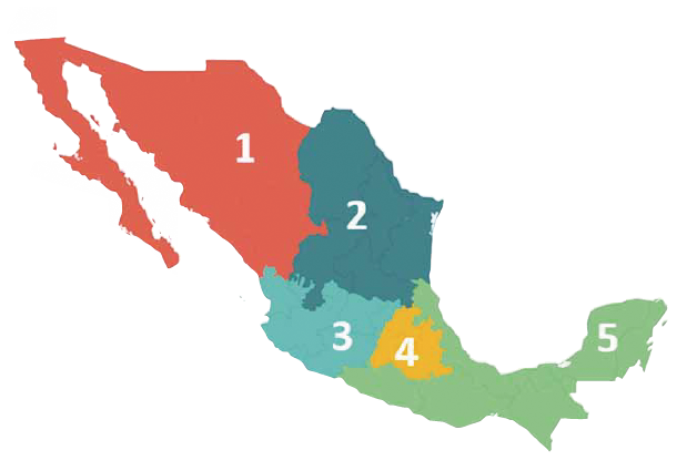
As a result of the vast natural wealth of Mexico, the ANAAE divided their task and
efforts in 5 regions
Northwest
Northeast
Center
Southeast
West
Northwest
The National Association of State’s Environment Authorities work towards creating strategic
alliances, cooperation and exchange of experiences between Government and Civil Society,
that promotes the exercise of environment governance, as the seminal point from which we can
create public policies that contribute to halt the degradation and loss of biodiversity, to
ensure and protect ecosystems, the risponsible use of our natural wealth and the fair
distribution of environmental services, complying with the Aichi goals.
The environmental authorities in the country recognize the importance the biodiversity
provides to the national development; so we fight for fair reorientation of resources to
this area. In addition to strengthening the institutional capacities and mainstreaming the
value of biodiversity in the government agenda, as a top priority.
Campeche Naturally Sustainable
Our mission as a state public institution is to promote and apply mechanisms that ensure the restoration and conservation of ecosystems and the use of natural resources with responsible and effective participation, as well as to ensure universal access to efficient and clean energy for the sustainable development of the State of Campeche.
As an environmental vision, we project that the State of Campeche by 2030 will be recognised for its orderly socio-economic growth and awareness of its environmental responsibility based on the generation and efficient use of clean energy, the responsible use of its natural resources as well as its leadership in the conservation and restoration of its socio-ecological systems.
About Campeche
Population: 928,363
Area: 57,924 km2
GDP: 22.3 billion dollars
Main industries: Crude oil
Nature preservation:45% of the state
Fauna and flora:4,379 species
Subnational Biodiversity Strategy and Action Plan
The public policy instruments of Campeche have been developed and implemented according to Aichi Biodiversity Targest, including the Subnational Biodiversity Strategy and Action Plan.
In 2010, through an initiative promoted by the National Commission for the Knowledge and Use of Biodiversity (CONABIO), under the coordination of the Autonomous University of Campeche and the Colegio de la Frontera Sur, the Ministry of Environment and Sustainable Use (SMAAS) published the book "Biodiversity in Campeche: State Study", composed of 11 sections and 125 contributions, with the participation of 128 authors from more than 30 institutions.
By 2011, the Ministry of Environment and Sustainable Use (SMAAS), promoted the integration of the Species Conservation Action Programmes (PACE) for the following species: Jaguar (Panthera onca), tapir (Tapirus bardii), white-lipped peccary (Tayassu peccary), spider monkey (Ateles geoffroyi) and king vulture (Sarcorhampus papa), with these instruments the aim is to recover the populations of these endangered species
In 2016, in coordination with CONABIO and the Ministry of Environment and Natural Resources (SEMARNATCAM), they published the Strategy for the Conservation and Sustainable Use in the State of Campeche (ECUSBIOCAM), the Strategy has a vision to 2030 and is aligned with the Aichi Biodiversity Targets and the Sustainable Development Goals. It has 7 strategic axes, 23 lines of action and 94 actions focused on conservation, restoration of ecosystems and recovery of populations of threatened species, the sustainable use and management of biodiversity, as well as prevention and attention to the factors that exert pressure on it.
For 2017, through SEMARNATCAM, the protection of the Zones Subjetc to Ecological Conservation (ZSCE) Balam Kin and Balam Kú, which together represent 520,190 hectares of jungle, was promoted through the creation, equipping and operation of Office of State Reserves, and the establishment of 4 guardhouses for these sites.
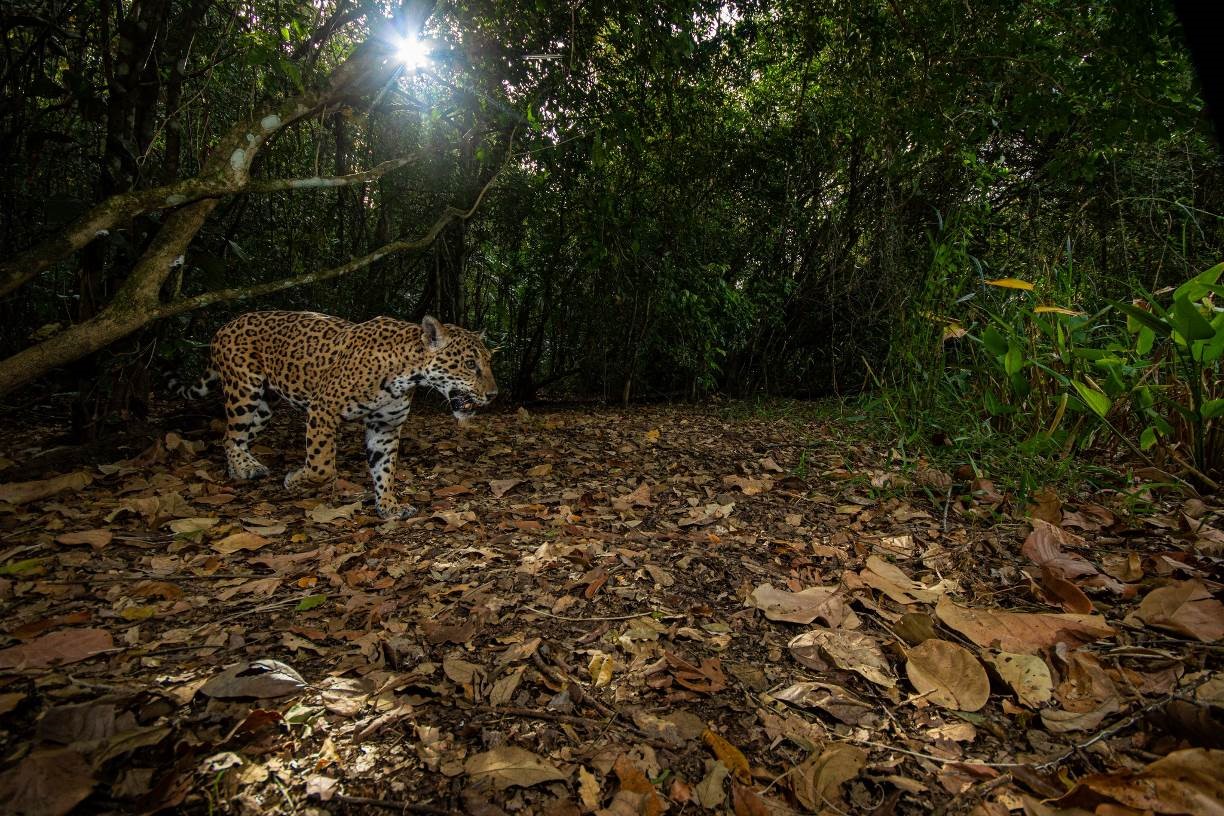
Biological Corridor of Jaguar
In 2018, SEMARNATCAM, in coordination with the Autonomous University of Tabasco (UJAT), implemented the Jaguar (Panthera onca) Census Project, for which 70 photo-trapping stations were established in an area of approximately 385 km2. With this Project, 141 events were recorded and 20 jaguars (10 males and 10 females) were identified.
For the year 2019, 7th South Southeast Region Meeting of Environmental Management Units (UMAS) was promoted, in which 4 keynote lectures and 26 papers were presented; 2 photographic exhibitions, 2 tastings of wild gastronomy, 4 panels of experts and 6 training workshops were offered. The UMAS are the legal figure in Mexico to carry out the conservation and management of wildlife in social (ejidos) or private properties, they also contribute to land conservation.
By 2019, the proposal for the legal recognition of Balam Beh Biological Corridor was also presented with the aim of guaranteeing the ecological connectivity of the priority species “jaguar” of the Maya Forest, in coordination with the organisation Panthera Mexico A.C. and the UJAT, connecting the natural protected areas of Laguna de Términos, Balam Kin, Balam Kú and Calakmul.
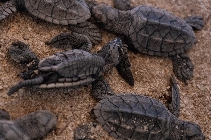
Sea Turtle Protection and Conservation Programme
The Government of Campeche State contributes to the recovery of endangered marine species through the Sea Turtle Protection and Conservation Programme. In the period 2010-2021, 21,866 nest of Hawksbill turtles (Eretmochelys imbricata) and 38,927 nests of White turtles (Chelonia mydas) have been protected in Campeche, and 1,593,147 Hawksbill turtle hatchlings have been released into the sea. During this period, 13 sea turtle camps operated and 176 kilometres of coastline were protected. Now, there are 16 sea turtle camps in our state.
The challenge of conservation: a very rich natural heritage in a small dynamic
country
Catalonia bears the primary responsibility for stewardship, to deliver to future generations a highly diverse and rich natural heritage, the healthy and resilient ecosystems that are the very foundation of our social and economic wealth.
Being a small nation under significant human pressure, our Biodiversity Strategy addresses the need to find a proper balance between land use and economic activity while conserving the lanscape, natural resources and environmental services.
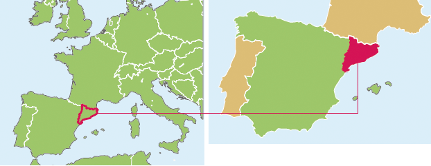
ABOUT CATALONIA
Population: 7.508.106 (NE of Spain)
Area: 32.108km2
Main ecosystems: forests and meadows (63%), crop lands (29%). Hilly lands with serveral
mountain ranges; 580 km of coast with marine grounds.
Fauna and flora: over 30.000 species, 3.600 vascular plants, 441 birds, 41 continental
fishes. Catalonia is a Mediterranean biodiversity hotspot.
Main pressures: 7 milions in 30% of the territory; intense industrial and agricultural
activity; 20 milion tourists/year; dense and extense road infrastructure; 110 alien species.
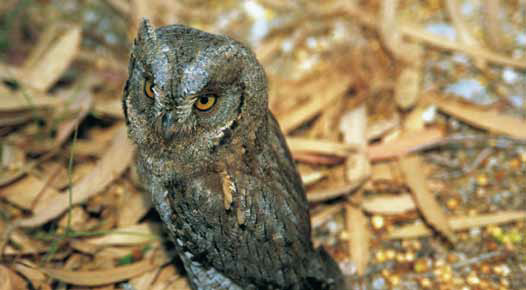
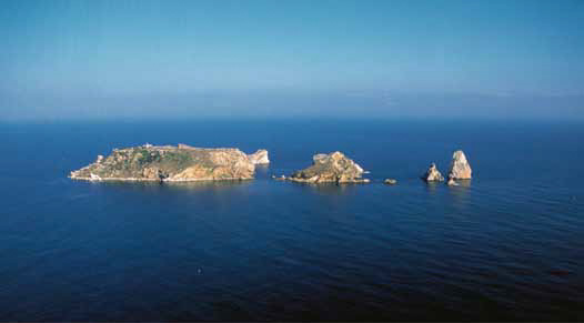
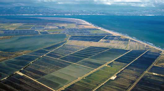
NATURE IN CATALONIA
Catalonia contains examples of different types of European landscape, on a small scale.
In an area of little more than 30,000 km2 there is a wide variety of substrates, soils,
climates, orientations, altitudes and distances from the sea. Combined, these elements
provide Catalonia with great ecological diversity and a remarkable wealth of landscapes,
habitats and species. There are over 600 types of natural and semi-natural habitats. 65%
of the territory conserves a high degree of natural features and protected areas cover
the 32% of the land.
We host vulnerable terrestrial and marine habitats, in greatest need of conservation,
such as calcicolous grasslands, mixed deciduous forests on rocky, shady slopes and
pedunculate oak forests. The marine habitats include rocky, infralittoral calcified
trottoirs (pavements) of Lithophyllum byssoides and extense Posidonia oceanica submarine
meadows. There are over 180 endangered or vulnerable species of flora, for which the
distribution is known.
Long term monitoring programmes on biodiversity and the natural heritage make it
possible to detect trends and also assist in decision making.
The response to the pressures has given rise to actions in the spheres of knowledge,
conservation and the sustainable use of natural heritage.
Knowledge
We organise the information on natural heritage
We assess the components of natural heritage
We identify trends through monitoring programmes
Conservation
We recover endangered species
We protect 32% of the territory
We restore degraded natural environments
We manage protected areas affected by human activity
We promote land stewardship
Sustainable use
We guarantee a sustainable land-use model
We change sector-based policies
Along with conservation, we promote new opportunities
We reinforce global climate change policies
Catalonia is very proactive in achieving the Aichi Targets, and has already different actions
implemented in response to the CBD Strategy, such as:
Rising public awareness of the value of biodiversity: there is a growing social awareness on
the issue and conservation of nature is a key issue for > 66% people
Integrated land-use planning: habitat conservation constitutes a key parameter for land-use
planning, there is a Barcelona’s metropolitan land-use plan and a Coastal System Land-use
Master Plan (2005)
Stregthening the Catalan natural protected areas system: protecting 32% of Catalonia and
including European Natura 2000 sites
Promoting habitat restoration: there is a Green Infrastructure plan that includes degraded
natural environments; especially in wetlands and coastal landscapes are being restored
Increasing knowledge on biodiversity: there is a Biodiversity Conservation and Monitoring
Program (2009), a Catalan Bd Database (25000 sp) and long-term monitoring programmes
Envisaging a Fund for Biodiversity Conservation in the new Law on Natural Heritage and
Biodiversity
‘Gangwon Province’ for Conservation of Nature, Harmony of Life and Peace
Gangwon Province established the ‘Biodiiversity Strategy in Gangwon Province’ as a
action for the conservation, utilization of biodiversity and implementation of
convention on biological diversity while organizing the CBDCOP12 in 2014. We are
carrying out 67 major tasks of strategy by 2020 through cooperation with various
stakeholders.
Population : about 1.56million
Area : 16,873.5?
Main ecosystems : Forests(82%), Lagoons, East coast with 314km of coastline,
National Parks, Wetlands
Nature preservation zone : about 29.9% of the province
Fauna and flora : 5,353species
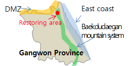
Gangwon Province is located in the eastern part of the Korean Peninsula and the second-largest
province of Korea in size. Gangwon Province is a mountainous province and is usually divided
into two areas, Yeongdong and Yeongseo. The eastern area, Yeongdong, is marked by steep slopes
with coastal plains, while the western area, Yeongseo, is marked by gentle slopes and mountains
containing the head water of some of Korea’s largest rivers. There are 18 cities and counties.
Its capital is Chun-cheon city which is located in the western part of Gangwon Province.
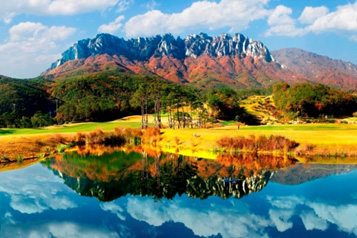
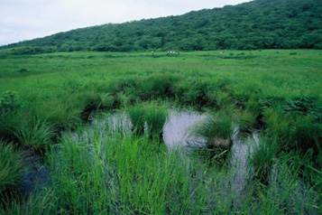
Nature in Gangwon
Gangwon Province has three core national axes including the Baekdudaegan mountain system, the
DMZ and the east coast as well as landscapes of karst areas and 269 wetlands. It has also
the largest number of endangered species in Korea.
Mt. Seoraksan National Park
(Oldest National park and First UNESCO biosphere reserve in Korea)
Daeamsan Yongneup Wetland
(National wetland and First Ramsar wetland in Korea)
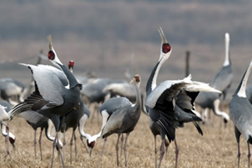
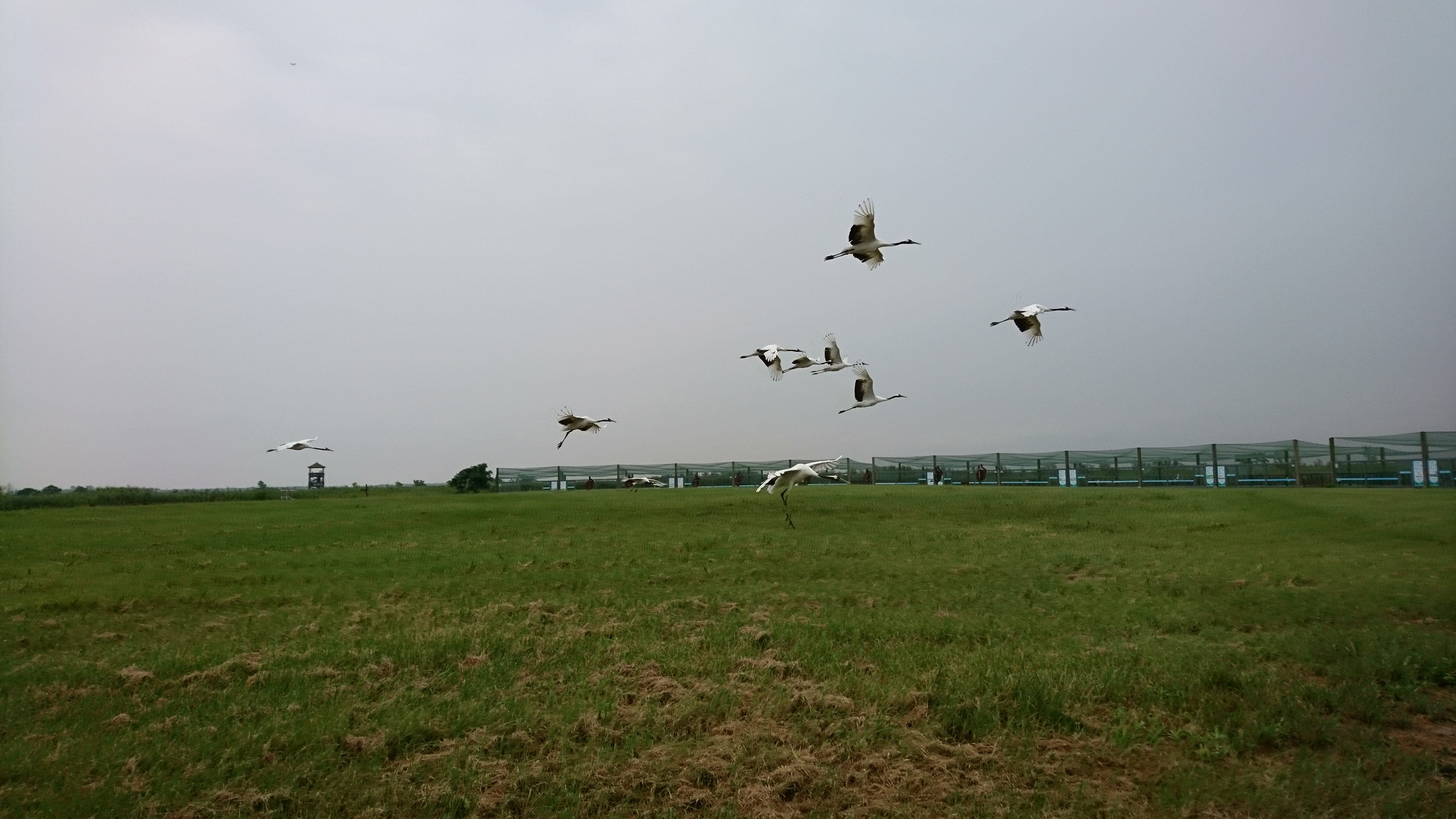
Crane(natural monument), Promoting Biodiversity by allowing rice straw to remain
after the harvest to provide food for migratory birds
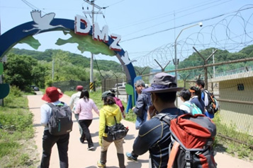
DMZ (Ecological peace park)
Biodiversity Strategy in Gangwon Province
Gangwon Province successfully established “the Biodiversity Strategy” in December, 2014 through
the investigation biodiversity, survey on residents’ awareness of biodiversity and expert
working group consultation. The document aims at responding to Aichi Targets as well as
sustainable use of ecosystem services and systematic preservation of biodiversity by
implementing 6 core objectives and 18 targets. The 6 core objectives are :
Mainstreaming biodiversity
Strengthening biodiversity conservation
Reducing threats to biodiversity
Sustainable use of ecosystem services
Building research and management system for biodiversity
Regional cooperation on biodiversity conservation
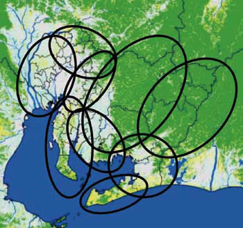
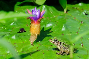
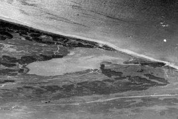
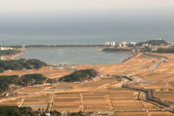
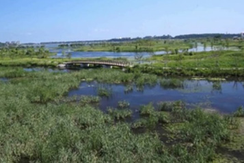
Restoration of endangered species- Aichi Target 12“Project of Gyeongpo Lake ”
In order to boost food production since 1970s, the wetland began to be landfilled to
cultivation land and has been used as private agricultural land until restoration.
The ecosystem was damaged by the water cycle interruption with surrounding lakes and
use of pesticides during the period of cultivation. After restoration, Prickly water
lily(endangered species) seeds which had been hidden for about 50 years, began to
germinate naturally.
Germinating naturally of Prickly water lily
wetland : 1960s
Landfilling to cultivation land and using as private agricultural land :
1970~2000
Restoration : 2013
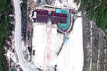
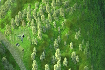
Restoration of ecosystem ? Aichi Target 15“Project of Misiryeong Pass ”
Misiryeong Pass is a national core ecological axis that connect to the DMZ as a
part of the national park. Restoration is under way by establishing a project to restore
damaged and disconnected ecological axes due to road and service area on the top of the
‘Misiryeong Pass after constructing a tunnel.
Before (Service area, parking lot )
After(currently restoring)
About Jiangsu
Jiangsu is located on China’s east coast.
It is where the Silk Road Economic Belt, the 21st-Century Maritime Silk Road, and the Yangtze River Economic Belt converge.
It is characterized by a solid industry foundation, a long history of civilization, and an abundance of scientific research and educational institutions.
Jiangsu Province has a total area of 107,200 square kilometres. As of 2020, the resident population of Jiangsu Province was 84.748 million.
The strong economy of Jiangsu contributes 10% of China’s GDP with only 1% of its land area and 6% of its population.
It is one of the regions with the greatest impetus and potential for development in China, with a regional GDP of CNY 10.27 trillion in 2020 that ranked first among various provinces and autonomous regions in China.
Natural Landscape of Jiangsu
The LOGO of Jiangsu is inspired by its iconic species, such as Neophocaena asiaeorientalis, Elaphurus davidianus, Magnolia zenii Cheng, and Grus japonensis, all 4 species are included in the IUCN Red List of endangered species. The simplified shapes of the species are put together to form the traditional Chinese character “蘇” which represents Jiangsu Province. The character symbolizes a fertile land of fish and rice with thriving vegetation, highlighting the biodiversity of Jiangsu Province.
Jiangsu is bestowed with rich natural resources and biodiversity since ancient times. An inventory of county-level biodiversity records a total of 6,083 species in the province, with 165 being rare or endangered species. The habitats of Grus japonensis and Ciconia boyciana in Jiangsu have further expanded to show a trend of growing populations. Top predators, such as Aquila chrysaetos and Prionailirus bengalensis, have also been recorded. With effective preservation of the ecological environment, the food chain is gradually becoming complete and stable.
There are a total of 31 natural reserves in Jiangsu Province, including 3 national nature reserves. Jiangsu Yancheng Wetland National Nature Reserve, Rare Birds was built in 1983. In 1992, it was promoted to a national natural reserve and named "Jiangsu Yancheng Wetland National Nature Reserve, Rare Birds". In 2002, it was included in Ramsar Convention (i.e. Convention on Wetlands of International Importance Especially as Waterfowl Habitat). It is the most important wintering habitat of the continental west line population of Grus japonensis cranes. It is called an "important national wetland gene bank" in the eastern coastal areas.
Jiangsu Yancheng Wetland National Nature Reserve, Rare Birds is an important business card of ecology and wetland of Jiangsu Province, one of the important migration channels of birds in the world, one of the hot areas of enrichment of biodiversity in the world, and a core member of "World Network of Biosphere Reserves" in "Man and Biosphere Programme" of UNESCO. The key protected objects are rarely wild animals in the wetland represented by Grus japonensis cranes, the coastal wetland ecosystem where they live, and the typical muddy plain coast landscape at the edge of the northern subtropical region.
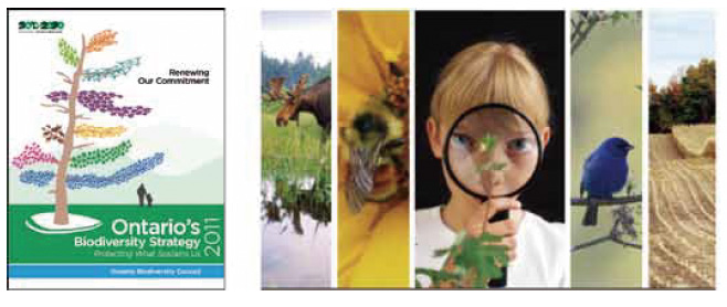
Protecting What Sustains Us
“Healthy ecosystems support healthy people, and we all have a responsibility to protect
our rich and abundant biodiversity. That’s why Ontario remains committed to protecting
our biodiversity and using our natural resources sustainably.
Working together with our partners ? governments, Indigenous communities, stakeholders
and the public ? we continue to lead and implement important conservation actions.”
About Ontario
13.5 million people
1.076 million km2
250,000 lakes (1/5 of world’s fresh water)
6% of world’s wetlands
11.2% parks and protected areas
30,000 known species
More than 50% forested
Ontario’s Biodiversity
Ontario supports a wide range of ecosystems and associated species, from the Great Lakes
and Carolinian forests in the south, to the Canadian Shield through much of the central
portion of the province, to the tundra of the Hudson Bay Lowlands in the Far North.
Ontario also supports globally rare ecosystem types (e.g., alvars) and several species
whose global populations largely reside within the province (e.g., Muskellunge, Lakeside
daisy). We proudly bear a global responsibility for their management and conservation.
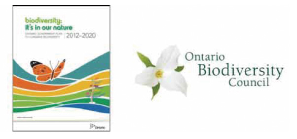
Source: Biodiversity: It’s In Our Nature 2012-2020
Ontario, Working Together To Advance Biodiversity Targets
Ontario’s Biodiversity Strategy is the strategic framework to advance the province’s
biodiversity vision and goals. The strategy is based on working together ? within and across
communities, organizations and sectors ? to attain mutually bene?cial goals and outcomes for
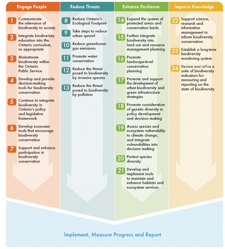
biodiversity. It identi?es actions according to four strategic directions: Engage People, Reduce
Threats, Enhance Resilience and Improve Knowledge.
To track progress, the strategy identi?es 15 biodiversity targets, modelled on the Aichi
Biodiversity Targets. The State of Ontario’s Biodiversity 2015 report was released by the
Ontario Biodiversity Council and provides an indication of Ontario’s progress toward its
targets, as well as an assessment of the status and trends for 45 indicators.
The Ontario Biodiversity Council was created in 2005 to guide implementation of Ontario’s
Biodiversity Strategy and report to the public on progress. The Council has 34 members from
conservation and environmental groups, industry associations, Indigenous organizations, academia
and governments. This broad membership embodies the spirit of mainstreaming biodiversity across
sectors. All sectors, including government, are encouraged to develop implementation plans that
identify speci?c actions they will take to advance Ontario’s Biodiversity Strategy. The Province
of Ontario’s response to this call to action is Biodiversity: It’s In Our Nature, Ontario
Government Plan to Conserve Biodiversity 2012-2020 setting out actions provincial ministries
will take alone or in collaboration with others.
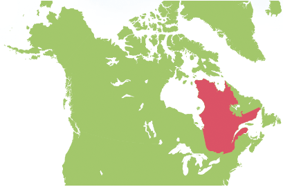
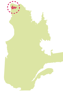
Quebec
Quebec, which hosts the Secretariat of the Convention on Biological Diversity, is among
the subnational states and regions that have developed tools for conserving their
biodiversity and meeting the Aichi Targets. Work aimed at protecting the riviere Kovik,
one of our most recent actions in the ?eld of endeavour, was carried out in a
sustainable development perspective and in close conjunction with local aboriginal
communities.
About Quebec
Population: 8,2 millions
Area : 1.7 million km2
Fauna and ?ora: more than 41367 species
Quebec is the largest province of Canada in size and the second-largest in terms of
population. Its capital is Quebec City. Quebec is characterized by the immensity of its
land mass, its forests that extend over more than half of its area, its countless lakes
and rivers and major mineral resources, as well as the St. Lawrence River.
The Quebec networkof protected areas
Quebec’s ecological reference framework: an effective conservation tool
Among its other uses, this mapping and territorial ecological classi?cation tool
identi?es territories that need priority protection and allows a validation of the
e?ciency of the network of protected areas to con?rm that it is representative of
Quebec’s ecosystems.
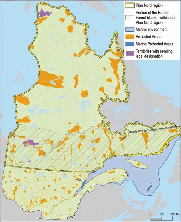
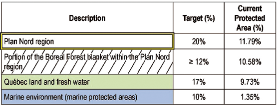
Ambitious conservation targets for Northern regions
Under the vast program of the Plan Nord, for the sustainable development and progress of
Northern Quebec, Quebec has set ambitious conservation targets that will enable it to
achieve Aichi Target 11 for protected areas.
These statistics include areas for which legal designation is pending. The protected
marine area target stems from Quebec’s Maritime Strategy for 2030.
A regional planning measure based on consultation
Since 2010 in all of Quebec’s regions, protected area planning has been conducted in
close collaboration with local and regional stakeholders. This process allows Quebec to
make sure that it’s planning is e?cient, representative and socially acceptable in
planning the network of protected areas.
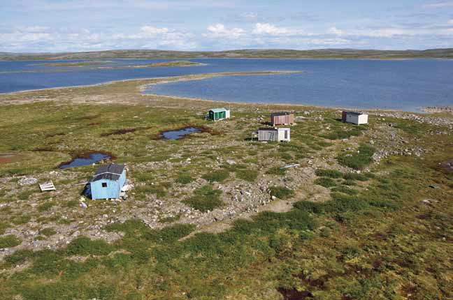
Protection of the riviere Kovik in Nunavik
Photo:Catherine Pinard - ARK
A river that is central to the conservation priorities of Northern communities
In 2011 and 2012, protected areas were the subject of a massive consultation held with
Nunavik communities. The report of the consultation clearly states that the riviere
Kovik and its watershed need priority protection because the region’s aboriginal
population carries out traditional activities there and depends on it for the Arctic
Char resource, which is a fundamental part of its diet.
In the spring of 2015, Quebec announced the creation of the 4,651 squarekilometre, proposed
Riviere-Kovik aquatic reserve, within which all industrial activity was immediately prohibited.
Photo:Catherine Pinard - ARK
Photo:Melanie Veilleux-Nolin - MDDELCC
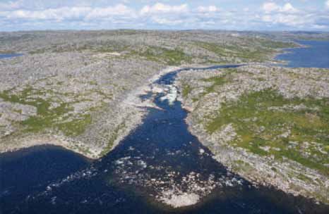
A sustainable development model
Thanks to a full year of co-operation among the area’s stakeholders, the ?nal design for
the proposed Riviere-Kovik aquatic reserve incorporated a wide variety of environmental,
social and economic interests, making the project an example of sustainable development.
Varied conservation interests
In addition to protecting an Arctic Char population that is essential to traditional
aboriginal ?shing practices, the reserve shows remarkable traces of past use by the
Inuit and the peoples that preceded them. The reserve is also located in the calving
area of the riviere aux Feuilles caribou herd and contains rare plant species.
Photo: Melanie Veilleux-Nolin - MDDELCC
Photo: Melanie Veilleux-Nolin - MDDELCC
Photo: Melanie Veilleux-Nolin - MDDELCC
Photo: Catherine Pinard - ARK
Partnerships towards biodiversity protection
To concretely advance in environmental issues, interests of diverse partners must be
harmonized, without forgetting the economic and social aspects of sustainable
development. To mainstream biodiversity, innovative solutions and renewed commitment
have to be fostered by the government, counting the with private sector and civil
society as important allies. Sao Paulo is joining e?orts to, in this way, advance in the
implementation of its BSAP.
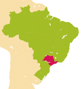
About the State of Sao Paulo
Population: 42 million
Area: 250,000 km2
Economic activity: 35% of industrial production and 34% of services o?ered by the
Brazilian market;
Territory under environmental protection: 18%.
The State of Sao Paulo is recognized as the largest economic and industrial hub in South
America. Today the state is the 19th largest economy in the world and the 2nd largest in
South America. When compared with other regions in the world, it is the 7th wealthiest,
generating about a third of Brazil’s GDP.
Nature in Sao Paulo
The State of Sao Paulo is home to two important biomes: the Atlantic Forest, which comprises
around 15,000 species of plants and more than 5% of the world's vertebrate species, and the
Cerrado, known as the richest Savannah of the world in terms of biodiversity. In addition, Sao
Paulo also has important biodiversity hotspots, such as the Atlantic Forest Biosphere Reserve,
with an area of 78 million hectares recognized by UNESCO for its unique biological richness. Up
to now, Sao Paulo is one of the only states of Brazil which has been able to reverse the
deforestation process, through regulation and inspection, solid restoration projects and bold
initiatives both with civil society and the private sector.
Today, 18% of our territory is under environmental protection, be it through large and small
conservation units, areas of permanent protection or legal reserves.
Currently, our main challenge is focused on enhancing management of these protected areas,
through sound public administration and counting with the aid of external partnerships.
For more information about the work carried out in Sao Paulo please access:
www.ambiente.sp.gov.br/en
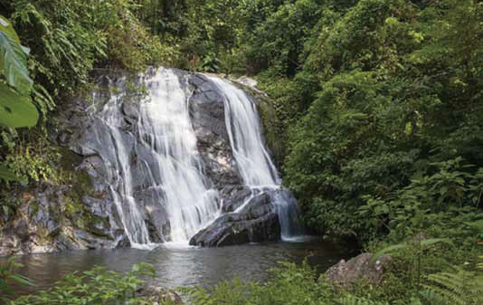
Ze-Bedeu Waterfall at the Itariru core of the Serra do Mar State Park. Photo: Lucas Cuervo
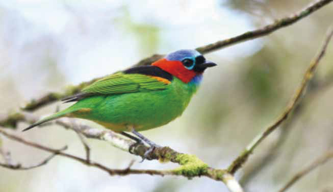
Saira- military (male) - Photo: Miguel Nema
Sao Paulo Biodiversity Action Plan 2011-2020
The State of Sao Paulo has had a strong presence in the biodiversity discussions since 1986, when the State Secretariat for the Environment (acronym SMA in Portuguese) was created. In 2011, the Sao Paulo Biodiversity Commission was established, approving the "Sao Paulo Action Plan 20112020“ towards the implementation of the Convention on Biological Diversity and, speci?cally, its Aichi Targets.
Initially designed with seven front actions, the Sao Paulo Action Plan was recently updated in line with the CBD Biodiversity Targets. These changes re?ect the knowledge gained after the ?rst years of implementation e?orts, mainly adapting itself to new action opportunities.
Through the Sao Paulo Action Plan we aim to promote synergies between the activities carried out by Sao Paulo and the many biodiversity initiatives at various levels (such as international, national and municipal), as well as by private institutions. Our goal is to encounter e?ective results regarding the achievement of the CBD’s objectives.
Nascentes Program
Conceived in 2014, at the peak of the water shortage in the southeast of Brazil, this is the largest initiative ever launched by the Government of the State of Sao Paulo to maintain and restore riparian forests.“ Nascentes” means“ springs” in Portuguese, and this program has the objective of restoring 20 thousand hectares of riparian forests. Integrating 12 State Secretariats, the program also includes several stakeholders, such as restoration specialists, entrepreneurs, the academic sector, civil society and landowners in need of restoring vegetation on their property.
Less than two years after its inception, the Program has a solid operational structure. 1,084 hectares were already restored (the equivalent to 1,512 soccer ?elds) and 1.8 million seedlings were planted within the state.
Water increase is already perceptible Photo: Diario O?cial de Sao Paulo